Showing posts with label utah. Show all posts

Monday, June 11, 2012

09 - Paragliding, Utah

SEEKING THE WHOO HOO ELEMENT!


Flyers at North Side, Point of the Mountain

Our travels into Northern Utah led us to the Provo area (just south of Salt Lake City). We established base camp at the Utah Lake State Park and were 20 miles from a world renowned paragliding/hang gliding hill called Point of the Mountain. We decided to check out the local talent the night we arrived. There amongst an assortment of students & flyers, we met Patrick Johnson. Pat's a local who knows the area & it's conditions extremely well, has over 11 years experience, an obvious love of flight, and the willingness to spend over an hour talking to us about the sport, answering all our questions.  It didn't take much convincing for us to wake up at 5am the next morning and start our training.  Dave had a goal to soar off a cliff while Avril just wanted to have fun and maybe get a little flying in...


Dave the kiting master!

So like any kind of training, our schedule for the next 10 days or so would include: wake up at 5am, check weather, confirm winds are favorable and in the right direction, if so, get up and leave around 6am for training. Spend 3 hrs training and sometimes have groundschool in Pat's basement after lesson (you need to complete at least 10 hrs of groundschool). Then spend the afternoon on your own, seeing the sights or napping! Around 5pm head back to see if the winds & crowds are in your favor for more training or simply people watch...In a perfect world with perfect wind conditions 5-7 days is all you need. But in our case it took a little longer due to weather. I have to say the 5am wake up time were getting to me, some days I would hope for non flying conditions just to get more time to sleep!!! 


In paragliding there is a P1 rating which tells an instructor you have completed so many hours and are proficient in handling the wing. All P1 students must be accompanied by an instructor when they want to go out flying. A P2 rating is where the training wheels are off and you can fly without the aid of an instructor. Other ratings like P3 & P4 are just more advanced/competition flying. Initially we were thinking P2 but due to the weather and time needed, we decided a P1 rating would meet our objectives.

Before leaving Texas I had taken some time in getting paramotoring lessons thinking that perhaps Dave & I would get his & her paramotors that would satisfy our aviation fix while traveling around the countryside. Again mother nature wasn't co-operative in March and the winds were too strong for training so I was only able to get 4 hrs of kiting lessons (without the motor) before we left. Dave flew a paramotor 10-15 years ago and so was already ahead of the learning curve. Utah, unlike where we live in Texas, has mountains, so paragliding is easily available. In Friendswood, we sit at 26' above sea level and so unless you were towed, it's a little harder to find good places to soar. But we have our scuba certification and you don't have to live beside the ocean to use it was our rationale... It's always fun to try new things and you just never know....


Does this harness make my butt look big???

We spent a couple of days kiting, just getting a feel for the wing and being consistent in getting clean stable launches into the air. Point of the Mountain has 2 sides, South Side & North Side. South Side is a great area to do toboggan runs where you run down the hill, inflate your wing and get 10-20' off the ground as you glide down the slope of the hill.  You are able to hear your instructor through his hand held radio that is attached to your harness.

My first toboggan run started off with squeals of delight, my landing....well, a little road rash as I landed like a duck! Well at least I now know what NOT to do!!!

DUDE, THAT WAS EPIC!
By my 6th lesson, I was flying higher, longer and with more control. At landing I could feel Pat's smile as he was pleased with his fledgling's progress AND the word epic was used in his critique....so it's official, dude, I'm, like, on my way to earning my wings, man! .... and yes, we met a few of those stereotypical types at the hill; harmless but very entertaining, indeed :)

TANDEMS ANYONE?


During our training we were given tandem rides. I think I got the better end of the deal by going early in our training which resulted in a 2 hr ride. Dave's turn came near the end of our training when the winds started doing their funky thing and not blowing as hard as we would have liked. As a result, his ride was only 15 min, not much lift, mostly sink...kind of like being flushed down a toilet! We had contemplated sticking around for a few more days hoping things would improve but we were also itching to get back to hiking and seeing more areas.


Dave & Pat our instructor!

KENNECOTT COPPER MINE


See those tonka trucks, they are actually 2 stories tall!
 During one of our weathered out days we drove to the world's largest open pit copper mine, spanning almost 3 miles wide and 3/4 of a mile deep.  Monster trucks drive like ants up and down the roads with ore that's been blasted out of the mine (2 blasts a day). Interesting fact, the drivers of these trucks sit 18' above ground and each tire on the truck cost between $18,000-$26,000 and only lasts 9 months! One nice by product of the copper mining is gold & silver. One person we met told us the mine pays for itself through the profits from the gold & silver and the 140,000 tons of ore a day is just gravy...(at the visitors center we didn't find any info. to confirm this).  The mine, discovered in 1903 has about 30 years of life remaining. What do you do with a big hole in the mountainside after you finish mining? One employee told us there are plans to fill it with water and make it into a huge lake! Pretty neat from the top elevation of 8000 all the way down to 4400 ft!


TIMPANOGOS CAVE

Image Detail
Doesn't look so bad on paper.... worth the hike!


We did manage a hike up to Timpanogos Cave one afternoon. To get to the entrance you have to walk a mile & half uphill, climbing 1100 ft in the process. This reminded me of the multiple hikes uphill carrying the wing while in the harness when training. The cave tour ended up being a 3 in 1 cave tour with tunnels connecting all 3 together. The cave keeps a cool 45 degree F (8 deg C) temp all year round and was discovered back in the early 1900's. A fun fact was that one of the caves we went through was discovered by two 14 yr old boys who kept it a secret for over 6 yrs before telling people about it.  I guess this was the start of the "man cave" era!

ONWARD & NORTHWARD

One great advantage to our trekking around is that it is very unscheduled. We are literally winging it when it comes to planning our future stops. For now, we figure we'll venture North of Utah into Idaho & into Wyoming to tour around. We have talked about possibly heading into Canada to visit family so stayed tuned....

Sunday, May 27, 2012

08 - National Parks Extravaganza, UT


For 7 days we traveled to different parts of Utah to sample the buffet of National Parks that were on offer. On the menu was Zion, Bryce Canyon, Arches, and Canyonland (which included the Needles).

View in front of us at our campsite!

Our first base campsite was just outside Glendale, UT. We already knew we were in rock country by the beautiful view right in front of our rv. Zion is about 30 miles South & Bryce Canyon is about 60 miles Northeast from base camp.

ZION
Zion is Utah's first National Park and we were stunned by it's beauty. I guess being topographically challenged for the last 12 yrs in Texas made what we saw in the park all the more impressive, all the way from 4000 - 9000 ft.


Checkerboard Mountain, all naturally formed


Another stunning view from Zion from Temple of Sinawava


Zion's preferred method of transportation within the park is their very frequent shuttle service. People can park their car and take the shuttle to places only it can go. With your trusty park guide in hand, you can hop on and off the shuttle and pick and choose what areas to frequent. To ride the shuttle nonstop to the top and back would take about 80 mins.

Never ending Rock Adjectives - one doesn't realize the multitude of words that come to mind when looking at the different formations here in Zion. During our time we were pointing and saying things like, "smooth cool waves, ribbon-like, wrinkly, crumbly, chunky, awesome, awe inspiring, intimidating, never ending....etc...

Tunnels
Zion has some tunnels in the park, what was different for us was that our dually truck was considered an oversized vehicle and so we had to pay an additional $15 to drive through the main tunnel. One benefit is that they have to stop traffic from the other direction and so you get the whole tunnel to yourself (and whatever other vehicles they allow behind you!).


Scrambling Required....What????


I think I can, I think I can....

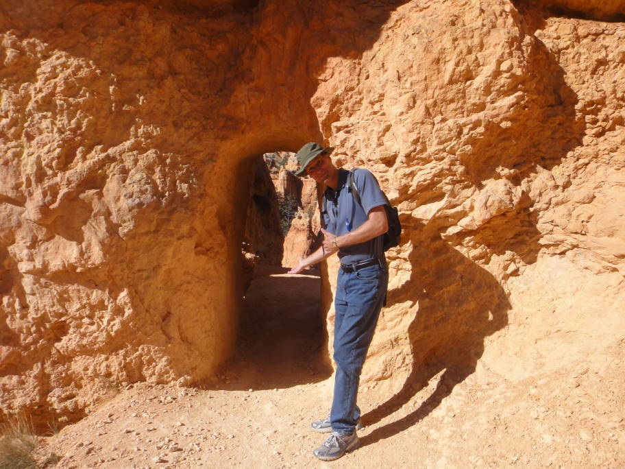
After a couple short 1.5 mile hikes, we came to a shuttle stop and spontaneously decided to have a wander around.  A hike that was not planned turned out in the end to be listed in our guide as a more strenuous hike, (which we failed to look up before embarking on it, convenient Dave!!). Hidden Canyon was the name of the trail and at first, judging from the starting point, looked like a series of switch backs that would take you on a "pleasant" 3 mile hike to a nice/scenic viewpoint....


In reality we did a lot of initial uphill switchbacks, which later turned into sheer drop offs and ledges with chains along the wall for "freak you out factor"... but it gets better... just as you are about to get to your destination and take in the view that you've been imagining is going to make the whole trek worthwhile, there's a sign: Scrambling Required... (@*!$) was a thought that one of us had after reading the sign....

At the end of Avril's & Dave's great hiking adventure, I can now use the word scramble in more than one other definition that does not include how I like my eggs... Hidden Canyon, an unforgettable hike & experience!


Looking straight up at the Hidden Canyon destination, it was more about the journey than the destination!


BRYCE CANYON
We spent 2 days touring Bryce, one mostly driving (for Catalina's enjoyment) and the other to do a 3 mile hike along the base of the crater, (from either Sunrise or Sunset Point), which some rv neighbors raved about the previous day. What an eyeful! again, beautiful scenery at Bryce, you just cannot take less than 100 pictures when visiting.


Avril, the human hoodoo...


Sign says: Attention Dogs:  Grrrrr, Bark, Woof   Good Dog  (Catalina looks like she understands)!


Along our base of the canyon trail


Stunning contrast between sky & ground


Welcome to my canyon home!


At the end of our base hike, going back up!

A lone tree growing in the slits of rock (behind Dave)

Ascending like ants out from a hole...


CORAL PINK SAND DUNES
Just a 30 min drive from our basecamp was a sign saying Coral Pink Sand Dunes, the word pink already had Avril's attention! We stopped at the park for a picnic lunch. The dunes were a lot like Whitesands in NM, except much warmer to the touch. Catalina seemed to like them as she scampered up the dune but we limited the play on account of the temps - but at least her paws were able to experience the fine powdery slopes.


ARCHES
Delicate Arch, the most photographed arch in the park

If you have calendars of National Parks, you most likely would have seen pictures of arches. Those arches are mostly likely have been taken from the Arches National Park. We were impressed with Mother Nature's creations but since this was near the tail end of our travelling we were getting to the point of being overstimulated. Arches National Park, having the greatest density of formations (2,500) was impressive but after the third and forth arch, we both agreed we'd seen enough! 


CANYONLAND - ISLAND IN THE SKY


Grand View Point Overlook

1200 ft cliffs from Grand View Point Overlook

Red baked earth, that's a comment I read in the Canyonland's brochure, yep, I have to agree.  This park is so large it is actually broken up into 3 different sections; Island in the Sky, the Needles, and the Maze. We walked along the upper rim & a crater area that some speculate was caused by a meteor. The panoramic views of our "mini Grand Canyon" were very impressive.  It is amazing to see the effects that water has had on shaping this environment. We read that over 15 million years ago, Canyonlands was close to sea level.  Thanks to volcanic activity and movements in the earths' crust, changed the landscape up to an elevation over 5000 feet.  Just hearing that makes you realize just how insignificant our time has been spent here on Earth....


Upheaval Dome, possibly caused by a meteor

Cliff edge or sun tanning spot?

The uranium boom in the 50's brought many prospectors to this area and hence created many dirt roads throughout the park. Ironically the holy grail of uranium was never found in Canyonlands and after 2 years of prospecting, everyone left. What was left was great 4x4 roads for us to enjoy today! The Maze is a section known for such offroading fun. Although our truck is 4x4 capable, we decided not to risk our only source of transportation, so that was one section of park we did not get to explore.  Here at our campsite approx. 75% of it's occupants have jeeps and off road vehicles of all shapes and sizes, "red neck heaven!"


Mesa Arch, Island in the Sky


Hope Dave's not afraid of heights!


Going...

Going...

Gone...or has she?


CANYONLAND - NEEDLES


When we first arrived into the park, looking out the window, we both wondered "Where are the Needles?"  Not knowing much about the park in advance, we had assumed it would be just riddled with spires and pointy peaks. I started wondering if this park should be renamed Haystack Park....but after a visit to the Visitor's Center we soon were on our way to discover scenic views by car and by hike. One of our longest times spent hiking so far was spent here at Needles. Probably the most memorable hike was a 3 hr. trek to Chesler Park.


I told Dave to focus on my foot that has nothing below it, guess he decided to focus on something else!


Always a great feeling to know you've reached your destination!

Hot & bothered....no, my water pack isn't leaking!

There were narrow fissures we had to walk through that were no wider than our shoulders(reminiscent of an amusement park where the sign at the ride says "must be this tall to get on ride")...  Of all parks, Canyonlands is indeed the quietest one, for crowds but also for wildlife. There were times we'd be walking along the trail and absolutely nothing could be heard - a great place to be alone with your thoughts!


FANCY FOOTWEAR OR NOT...
One thing we packed for our trip was hiking boots but since they had not seen any action for about 15 years they quickly showed their age on our first walk. Both of our soles disintegrated within minutes so our running shoes became our trusty backup. For the type of trails and terrain we've been walking on, they've worked out fine giving enough support and traction for the steep hills while not being water or sand proof, our feet haven't given us any complaint. While walking on many of the trails, we have seen men & women in flip flops and in 2 cases bare feet...you have to wonder what goes on in their minds when setting out for a 1-2 hr hike...

DEAD HORSE POINT STATE PARK


After 2 days trapped in the rv, the wind finally settled down. We decided to add an extra day to our stay at the campground to take in one last trip.
One of our views from the campsite


No more blue sky... 40-60 mph gusts!


Dead Horse is just off the road to Canyonlands.  The point is like a peninsula, with many outlook points along the rim trails of the point. We started at the top and worked our way counter clockwise, sometimes walking out to the outlooks. Overall, we spent about 3.5 hrs walking, taking in pretty views of the Colorado River 2000 ft below us. The legend around the name isn't a nice one; cowboys, corralled wild horses at the point and those unlucky enough to not be selected were left stranded on the point without water. So instead, here are some pretty pictures of what the 3 of us got up to, yes, it's a dog friendly park which was a nice change from the National Park no dog on trails rules.

Yes even dogs close their eyes just before their picture is taken!


Views from the Point (most Southern part of the trail)


A bold chipmunk wanting to eat our lunch...Catalina had other thoughts for him!


NATIONAL PARK PASSES - Our neighbor Louise suggested we buy a National Park Pass for $80 per family per year. We always say thank you to her when we approach the park gates, what a great cost savings since most parks charge from $10-$25 per vehicle. Passes can be purchased at any park, so if you think you'll be doing a lot of National Park visiting, it's a great investment.


WHAT'S NEXT? - We have been delayed for a couple of days on account of a wind storm in the Moab area. So far the rv has resisted gusts of nearly 60mph, which on the bright side has allowed me to get up to date on our adventures, bake some comfort food, and learn a little more about blogging.

Thanks to Sue who we met here at our campsite, I now know I can add other features to this blog that will allow people to sign up and follow our postings in a more timely manner, (see far right column). I hope to utilize indexing too so when more entries start to pile up, one can search for a specific place, State or subject and hopefully it will be a place or activity we have experienced. Any feedback you might have to improve or fix is always appreciated! We are hoping to head North to Salt Lake City to check out some paragliding schools in the area... maybe experience a different kind of flying - stay tuned!